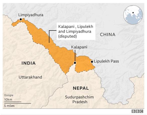
Indo- Nepal border issue:
- Posted By
10Pointer
- Categories
India & world
- Published
26th Oct, 2020
-
- After months of simmering dispute with India over the Kalapani issue, Prime Minister K.P. Sharma Oli recently indicated a softer line when he used an old map of Nepalto greet everyone on the festival of Vijaya Dashami.
- The old map does not show the region of Kalapani-Lipulekh-Limpiyadhura, which is part of India’s Pithoragarh district.
- Recently, Kalapaniwas shown as part of Nepalese sovereign territory in the new map.
- This map was made part of the insignia of the Nepalese state by an amendment on June 13.
- Kalapani is located in the easternmost corner of Uttarakhand’s Pithoragarh district.
- It Shares a border on the north with the Tibet Autonomous Region of China and Nepal in the east and south.

